Know the sea after the share from the Prince of the Devil, the pictures are beautiful… and with this sacred location, this destination has a great attraction to strange, though that to come out, it must be an easy journey.
[caption id = "attachment_2428" align = "aligncenter" width = "600"] Is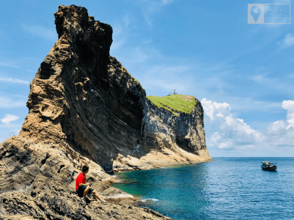 let, Sacred Destinations & beautiful Great. [/caption] The sea, also the name of the visit, the comedy… is the independent island located approximately 65km away from Phu Quy Island (Binh Thuan). This is also defined as the A6 point on the Vietnamese territorial infrastructure. Luckily she was involved in the late September, and the sisters ' elders ' in the world, experience great things that might not be easy to get. After a few hours in the sea, the Bund, a giant rock cube that is gradually far behind, looks like a comedy, or a whale. [caption id = "attachment_2442" align = "aligncenter" width =
 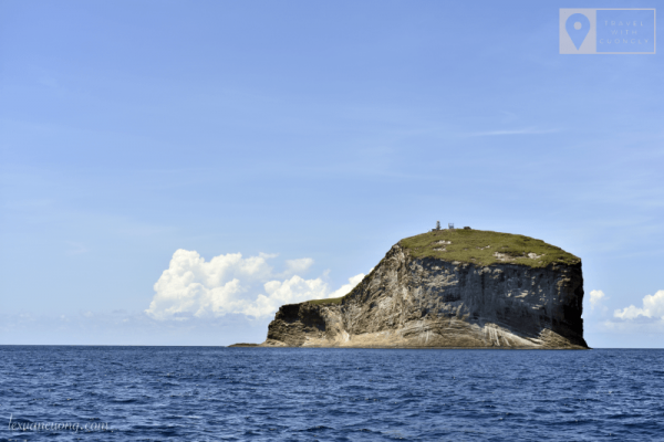 "600"] The sea is from the far, shaped like a comedy or a elephant. [/caption] [caption id = "attachment_2443" align = "aligncenter" width = "60
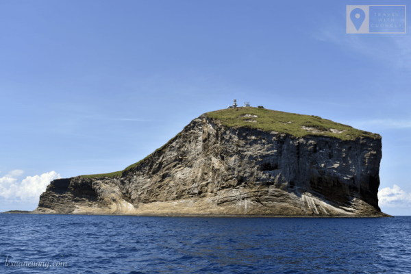 0"] Just a little closer to the lighthouse. [/caption] Ignoring the fatigue by long distance, the "swaying" of the clock hours on board… When I put the first footsteps on the sea, the heart was broken for joy. This place is not only beautiful, mighty, but also a great meaning. [caption id = "attachment_2447" align = "aligncenter" width="
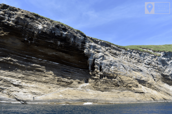 6000"] the tunnel to the sea, lying halfway between the giant Sea cube. [/caption] The cliff stands in the sea. In the top are swallow birds, the beaver is nesting. This season is not a reproductive purchase so there are no more birds about nesting, to eggs. [caption id = "attachment_2448" align = "aligncenter" width
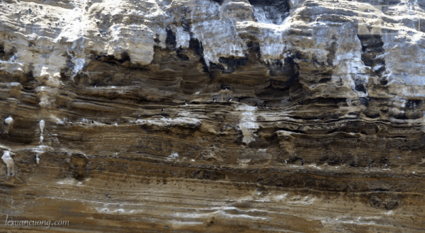 = "600"] Swallow birds, au… Nesting on cliffs in the sea. [/caption] The sea is like a giant stone block between the sea, which houses a block of buildings and tunnels stretching to the top of the mountain. [caption id = "attachment_2445" align = "aligncenter" width
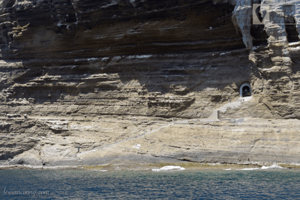 ="6000"] the tunnel to the sea, lying halfway between the giant Sea cube. [/caption] The housing block, built as a reinforced plot, where the activities of the Sea Lighthouse managers, average each one will work on four months prior to visiting the house. [caption id = "attachment_2440" align = "aligncenter" width = "600"] Hous
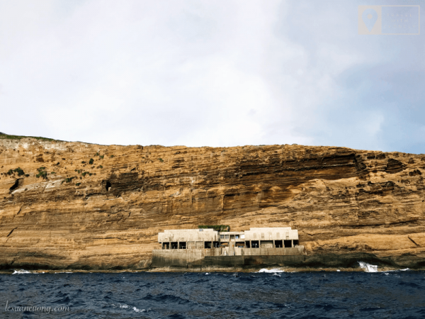 ing block, the residence of the officers in the sea. Look as far as a lot of solid. [/caption] [caption id = "attachment_2439" align = "aligncenter" width = "515
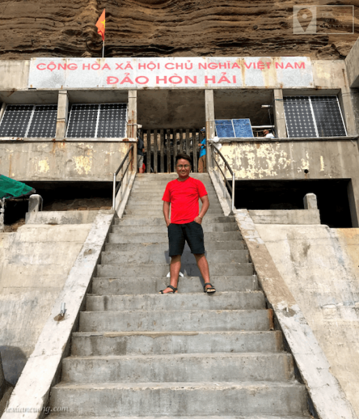 "] Front block houses in the sea. [/caption] [caption id = "attachment_2438" align = "aligncenter" width
 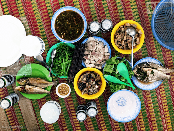 = "600"] Making lunch with officers on the island. [/caption] [caption id = "attachment_2452" align = "aligncenter" width="60
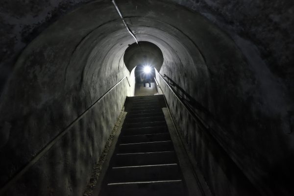 00"] the Trans-island tunnel. (Photo: Ms. Le Trang) [/caption] [caption id = "attachment_2437" align = "aligncenter" width = "6
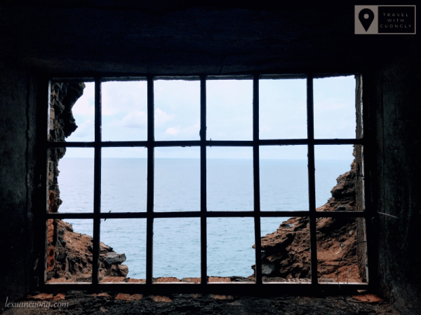 00"] Angle of view from the wind, tunnel on the sea. [/caption] On the highest peaks of the island is the coastal lighthouse, under the management of the Maritime Safety Corporation (the Ministry of Transportation). Lighthouse helps ships locate, orient when moving at sea. [caption id = "attachment_2451" align = "aligncenter" width =
 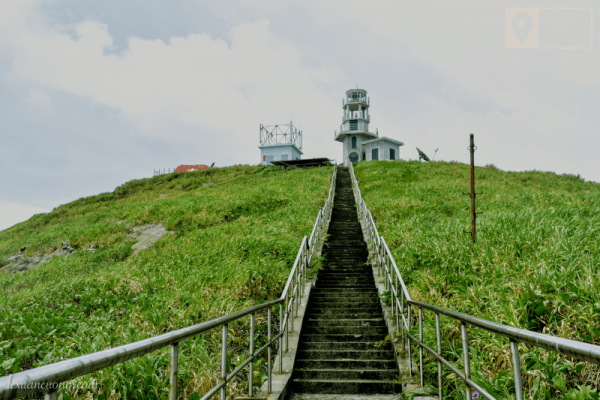 "600"] the road onto the Islet lighthouse. [/caption] [caption id = "attachment_2435" align = "alignc
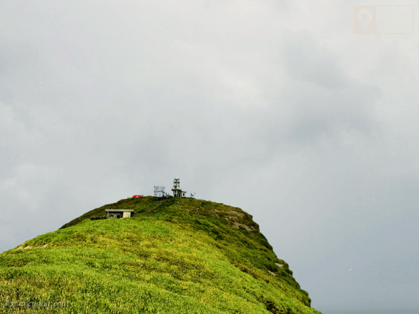 enter" width = "600"] Lighthouse of the lighthouse of a coastal sovereignty from the far. [/caption] was built from 1999-2004, which works on the island Sea was both an excellent attempt, even to be modified by the human soldiers ' lives. And from September 6/2017, completed the finished mark of the master beer, A6 points on the Vietnamese territory. [caption id = "attachment_2431" align = "aligncenter" width = "6
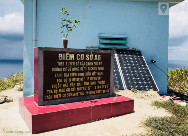 00"] base point A6 on the sea. Where to define the Vietnamese territorial roads. [/caption] [caption id = "attachment_2432" align = "aligncenter" width
 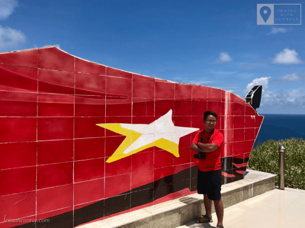 = "600"] The flag was built to assert sovereignty over the island of insular. [/caption] [caption id = "attachment_2433" align = "aligncenter" width =
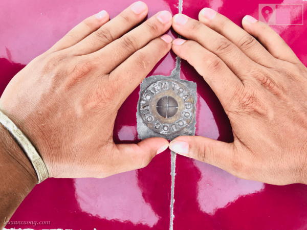 "600"] The country's coordinates. [/caption] The iron piles, each used to anchor the rope, scroll down to the building of the sea. [caption id = "attachment_2436" align = "aligncenter" width = "4
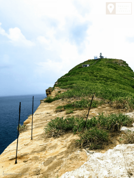 50"] The former iron piles used to drop the rope climbed down the bottom. [/caption] [caption id = "attachment_2450" align = "aligncenter" width = "6
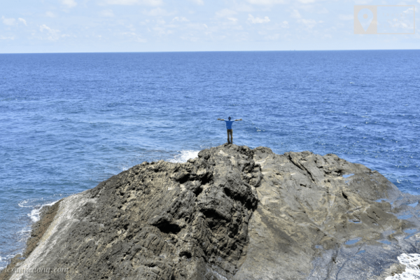 00"] The Sea of Heaven, where the sovereignty marks Vietnam. [/caption] [caption id = "attachment_2434" align = "aligncenter" width = "600"] T
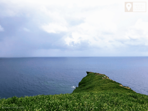 he cliffs are super beautiful and dangerous in the sea. [/caption] The sea, not easy to put your feet, these experiences will certainly be difficult to forget, thank you for your companion and all the Help. Currently, we do not have to organize the program to the sea but if you do really love the island Sea and the special landmarks of the country can contact British Huy: 0908720711 to arrange for participation. Cruise to the sea is certainly a long journey of power, but there will certainly be many sacred experiences.
For more information about 11 of the base points on Vietnam's territory:
[caption id = "attachment_2453" align = "aligncenter" width = "600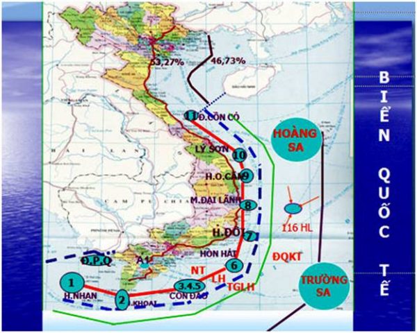 "] Red line connects 11 points from the swallow to the grass dunes called the baseline, the blue boundary is called the National border at sea (source: vietnamnet. vn) [/caption] coordinates the base line benchmark to calculate Territorial width of Vietnamese continent:
| Point | Location and geography | Coordinates N | Longitude E |
| 0 | Located on the southwestern boundary of the historic waters of the Socialist Republic of Vietnam and the People's Republic of Cambodia. | ||
| A1 | In the swallow, tho Chu archipelago, Kien Giang province. | 9015 ' 0 | 103027 ' 0 |
| A2 | In the odd rock in southeast of the potato, Minh Hai province. | 8022 ' 8 | 104052 ' 4 |
| A3 | In great fortune, Con Dao, Vung Tau District-Con Dao. | 8037 ' 8 | 106037 ' 5 |
| A4 | In Hon Lang, Con Dao. | 8038 ' 9 | 106040 ' 3 |
| A5 | In the seven sides, Con Dao. | 8039 ' 7 | 106042 ' 1 |
| A6 | In the Bund (Phu Quy Island group), Thuan Hai province. | 9058 ' 0 | 109005 ' 0 |
| A7 | In the twin, Thuan Hai province. | 12039 ' 0 | 109028 ' 0 |
| A8 | At the Cape of Representatives, Phu Khanh Province. | 12053 ' 8 | 109027 ' 2 |
| A9 | In Mr. DAO, Phu Khanh Province. | 13054 ' 0 | 109021 ' 0 |
| A10 | At son Dao Island, Nghia Binh Province. | 15023 ' 1 | 109009 ' 0 |
| A11 | In Con Dao island, Binh Tri Thien Province. | 17010 ' 0 | 107020 ' 6 |